
Cancel Topographic Maps & Trails Subscription
Published by LW Brands, LLC on 2026-01-02Uncover the ways LW Brands, LLC (the company) bills you and cancel your Topographic Maps & Trails subscription.
🚨 Guide to Canceling Topographic Maps & Trails 👇
Note before cancelling:
- The developer of Topographic Maps & Trails is LW Brands, LLC and all inquiries go to them.
- Check the Terms of Services and/or Privacy policy of LW Brands, LLC to know if they support self-serve subscription cancellation:
- Always cancel subscription 24 hours before it ends.

🌐 Cancel directly via Topographic Maps & Trails
- 🌍 Contact Topographic Maps & Trails Support
- Mail Topographic Maps & Trails requesting that they cancel your account:
- Login to your Topographic Maps & Trails account.
- In the menu section, look for any of these: "Billing", "Subscription", "Payment", "Manage account", "Settings".
- Click the link, then follow the prompts to cancel your subscription.
End Topographic Maps & Trails subscription on iPhone/iPad:
- Goto Settings » ~Your name~ » "Subscriptions".
- Click Topographic Maps & Trails (subscription) » Cancel
Cancel subscription on Android:
- Goto Google PlayStore » Menu » "Subscriptions"
- Click on Topographic Maps & Trails
- Click "Cancel Subscription".
💳 Cancel Topographic Maps & Trails on Paypal:
- Goto Paypal.com .
- Click "Settings" » "Payments" » "Manage Automatic Payments" (in Automatic Payments dashboard).
- You'll see a list of merchants you've subscribed to.
- Click on "Topographic Maps & Trails" or "LW Brands, LLC" to cancel.
Have a Problem with Topographic Maps & Trails? Report Issue
About Topographic Maps & Trails?
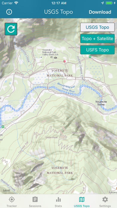
1. USGS Topo is a tile cache base map service that combines the most current data in The National Map (TNM), and other public-domain data, into a multi-scale topographic reference map.
2. USGS Imagery Topo is a tile cache base map of orthoimagery in The National Map and US Topo vector data.
3. Orthoimagery data are typically high resolution images that combine the visual attributes of an aerial photograph with the spatial accuracy and reliability of a planimetric map.
4. Data themes included are Boundaries, Geographic Names, Transportation, Contours, Hydrography, Land Cover, Shaded Relief, Trails, etc.
5. The USFS Topo Map Area of Interest covers the USFS National Forests and Grasslands.