How to Delete Active Wildfire Tracker Map. save (43.31 MB)
Published by corey hoggardWe have made it super easy to delete Active Wildfire Tracker Map account and/or app.
Table of Contents:
Guide to Delete Active Wildfire Tracker Map 👇
Things to note before removing Active Wildfire Tracker Map:
- The developer of Active Wildfire Tracker Map is corey hoggard and all inquiries must go to them.
- Check the Terms of Services and/or Privacy policy of corey hoggard to know if they support self-serve subscription cancellation:
- The GDPR gives EU and UK residents a "right to erasure" meaning that you can request app developers like corey hoggard to delete all your data it holds. corey hoggard must comply within 1 month.
- The CCPA lets American residents request that corey hoggard deletes your data or risk incurring a fine (upto $7,500 dollars).
Data Active Wildfire Tracker Map Collected from You 🔏
-
Data Not Linked to You: The following data may be collected but it is not linked to your identity:
- Location
- Usage Data
↪️ Steps to delete Active Wildfire Tracker Map account:
1: Visit the Active Wildfire Tracker Map website directly Here →
2: Contact Active Wildfire Tracker Map Support/ Customer Service:
- 74.42% Contact Match
- Developer: Qvyshift LLC
- E-Mail: support@qvyshift.com
- Website: Visit Active Wildfire Tracker Map Website
- 82.61% Contact Match
- Developer: Severe WX Warn
- E-Mail: corey@severewxwarn.com
- Website: Visit Severe WX Warn Website
- Support channel
- Vist Terms/Privacy
Deleting from Smartphone 📱
Delete on iPhone:
- On your homescreen, Tap and hold Active Wildfire Tracker Map until it starts shaking.
- Once it starts to shake, you'll see an X Mark at the top of the app icon.
- Click on that X to delete the Active Wildfire Tracker Map app.
Delete on Android:
- Open your GooglePlay app and goto the menu.
- Click "My Apps and Games" » then "Installed".
- Choose Active Wildfire Tracker Map, » then click "Uninstall".
Have a Problem with Active Wildfire Tracker Map? Report Issue
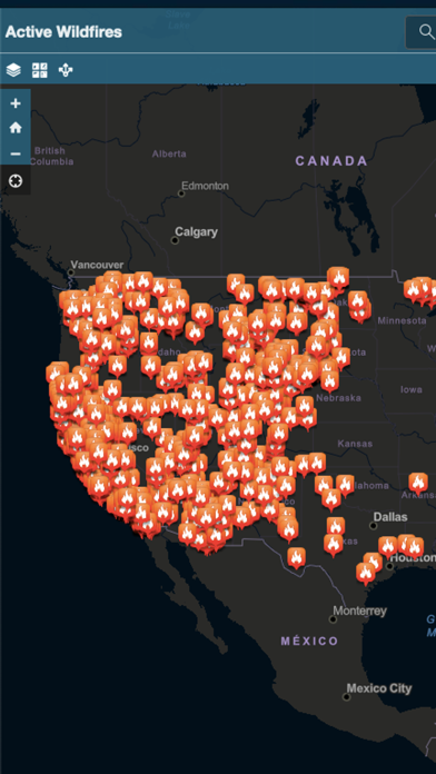
🎌 About Active Wildfire Tracker Map
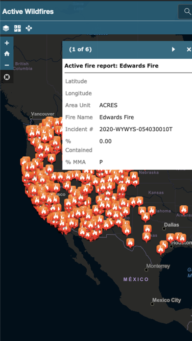
1. Active Wildfire Tracker Map is an interactive mapping application that tracks the current active wildfires in the US.
2. The data is updated hourly and offer GPS capabilities.