How to Delete OvitalMap. save (86.97 MB)
Published by Beijing Ovital Software Co.,Ltd.We have made it super easy to delete OvitalMap account and/or app.
Table of Contents:
Guide to Delete OvitalMap 👇
Things to note before removing OvitalMap:
- The developer of OvitalMap is Beijing Ovital Software Co.,Ltd. and all inquiries must go to them.
- The GDPR gives EU and UK residents a "right to erasure" meaning that you can request app developers like Beijing Ovital Software Co.,Ltd. to delete all your data it holds. Beijing Ovital Software Co.,Ltd. must comply within 1 month.
- The CCPA lets American residents request that Beijing Ovital Software Co.,Ltd. deletes your data or risk incurring a fine (upto $7,500 dollars).

↪️ Steps to delete OvitalMap account:
1: Visit the OvitalMap website directly Here →
2: Contact OvitalMap Support/ Customer Service:
- 19.05% Contact Match
- Developer: Google LLC
- E-Mail: apps-help@google.com
- Website: Visit OvitalMap Website
Deleting from Smartphone 📱
Delete on iPhone:
- On your homescreen, Tap and hold OvitalMap until it starts shaking.
- Once it starts to shake, you'll see an X Mark at the top of the app icon.
- Click on that X to delete the OvitalMap app.
Delete on Android:
- Open your GooglePlay app and goto the menu.
- Click "My Apps and Games" » then "Installed".
- Choose OvitalMap, » then click "Uninstall".
Have a Problem with OvitalMap? Report Issue
🎌 About OvitalMap
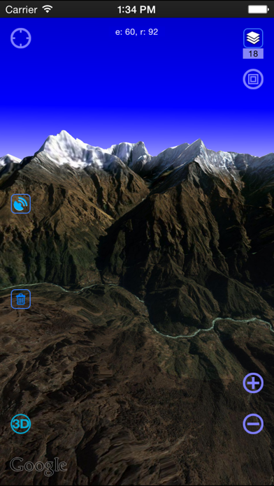
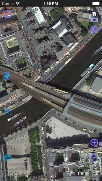
1. OvitalMap is a map browser developed by Beijing Ovital Software Co.,Ltd. based on Google API, supporting offline views of Google Map, satellite map and terrain map, as well as voice navigation.
2. The API search engine will offer information about your location, roads, and buses, as well as hotels, entertainment, banks, restaurants, supermarkets, gas stations, parking lots, and tourist attractions nearby a certain position.
3. When you are using the system to chat with a friend (just like using QQ or MSN), you can insert a location tag, travel solution, or a map created by yourself.
4. We also can direct output the contour line in 10 meters on the satellite map, which helps you directly see the elevation data on satellite map.
5. Elevation data service, the Cloud of Ovitalmap integrate SRTM3 elevation data around the world.
6. Google API offers a search engine to choose the best route for you.
7. There will be voice navigation for the walk or driving route suggested by the system.
8. At present it supports Google map, Google satellite map and Google terrain map.
9. You can share your location at a certain moment with selected relatives or friends so that they will know your position on the map.
10. The location of friends will be shown on the map dynamically so that you can know where they are and don’t need to worry losing their positions any more.
11. The system can highlight moving tracks of more than one friend with lines of different colors.
12. Thus, if you know the position of your friend, you can draw a route on the map and send it to him.
13. The system can record your tracks, which can be saved and sent to friends.
14. It will find an optimum solution for your travel, either by walk,bus or driving.