Cancel Iphigénie | Offline Maps Subscription
Published by Max Barel on 2026-05-06Uncover the ways Max Barel (the company) bills you and cancel your Iphigénie | Offline Maps subscription.
🚨 Guide to Canceling Iphigénie | Offline Maps 👇
Note before cancelling:
- The developer of Iphigénie | Offline Maps is Max Barel and all inquiries go to them.
- Always cancel subscription 24 hours before it ends.
🌐 Cancel directly via Iphigénie | Offline Maps
- 🌍 Contact Iphigénie | Offline Maps Support
- Mail Iphigénie | Offline Maps requesting that they cancel your account:
- E-Mail: support.android@iphigen.ie
- Login to your Iphigénie | Offline Maps account.
- In the menu section, look for any of these: "Billing", "Subscription", "Payment", "Manage account", "Settings".
- Click the link, then follow the prompts to cancel your subscription.
End Iphigénie | Offline Maps subscription on iPhone/iPad:
- Goto Settings » ~Your name~ » "Subscriptions".
- Click Iphigénie | Offline Maps (subscription) » Cancel
Cancel subscription on Android:
- Goto Google PlayStore » Menu » "Subscriptions"
- Click on Iphigénie | Offline Maps
- Click "Cancel Subscription".
💳 Cancel Iphigénie | Offline Maps on Paypal:
- Goto Paypal.com .
- Click "Settings" » "Payments" » "Manage Automatic Payments" (in Automatic Payments dashboard).
- You'll see a list of merchants you've subscribed to.
- Click on "Iphigénie | Offline Maps" or "Max Barel" to cancel.
Subscription Costs (Saved) 💰
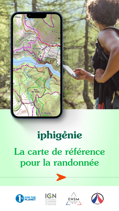
iPhiGéNie offers a variety of subscription tiers based on the user's needs. The basic subscription is free and provides access to the user's location on the map. However, to access the app's tools, the user needs to purchase the Vmax module, which is a one-time purchase. The editor subscription is required to access certain maps, and it costs €9.99 per year. Additionally, there is a premium subscription that costs €19.99 per year and provides access to all maps and features, including the ability to download maps for offline use, create and edit GPS tracks, import useful markers, follow a GPS track with guidance sounds, customised vocal alerts, and beacon. The premium subscription also allows users to archive and share their tracks and markers in GPX format and provides cloud access. All subscriptions are recurrent, and their renewal is automatic.
Have a Problem with Iphigénie | Offline Maps? Report Issue
About Iphigénie | Offline Maps?
1. Topographic and road maps (current, 1950)**, Scan 1/25k all scales**, OACI (aviation)**, ESRI** (worldwide), French satellite view (current, 1950-1965, 2000-2005, 2006-2010), cadastre**, French administrative limits, Plan IGN V2, slopes 30° 35° 40° 45°, restricted drone areas, 19th century maps, Paris satellite view (1818-1824, 1906, 1965-1980).
2. Topographic and road maps, satellite view, hiking trails, gliding maps, OACI (aviation), geological maps, slopes >30°.
3. But much more than just your location on a map, iPhigénie offers you a variety of tools that will allow you to prepare, follow, record, archive and share your outings.
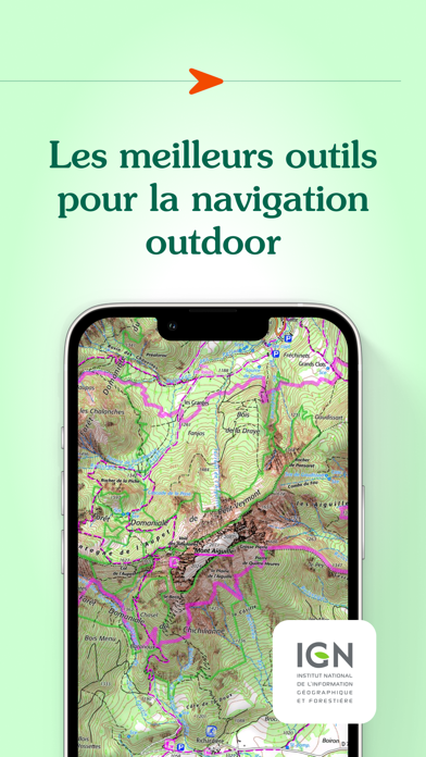
4. Iphigénie is a complete mapping app which - thanks to more than 40 maps - will allow you to find your way anywhere in the world.
5. By selecting iPhiGéNie, you enjoy not only a complete and stable application, but also a customer-focused team available to answer all your questions and assist you as you progress.


