How to Delete ORTOVOX ALPINE TOURING APP. save (53.73 MB)
Published by Outdooractive GmbHWe have made it super easy to delete ORTOVOX ALPINE TOURING APP account and/or app.
Table of Contents:
Guide to Delete ORTOVOX ALPINE TOURING APP 👇
Things to note before removing ORTOVOX ALPINE TOURING APP:
- The developer of ORTOVOX ALPINE TOURING APP is Outdooractive GmbH and all inquiries must go to them.
- The GDPR gives EU and UK residents a "right to erasure" meaning that you can request app developers like Outdooractive GmbH to delete all your data it holds. Outdooractive GmbH must comply within 1 month.
- The CCPA lets American residents request that Outdooractive GmbH deletes your data or risk incurring a fine (upto $7,500 dollars).
↪️ Steps to delete ORTOVOX ALPINE TOURING APP account:
1: Visit the ORTOVOX ALPINE TOURING APP website directly Here →
2: Contact ORTOVOX ALPINE TOURING APP Support/ Customer Service:
- Verified email
- Contact e-Mail: info@ortovox.com
- 100% Contact Match
- Developer: Outdooractive AG
- E-Mail: support@outdooractive.com
- Website: Visit ORTOVOX ALPINE TOURING APP Website
Deleting from Smartphone 📱
Delete on iPhone:
- On your homescreen, Tap and hold ORTOVOX ALPINE TOURING APP until it starts shaking.
- Once it starts to shake, you'll see an X Mark at the top of the app icon.
- Click on that X to delete the ORTOVOX ALPINE TOURING APP app.
Delete on Android:
- Open your GooglePlay app and goto the menu.
- Click "My Apps and Games" » then "Installed".
- Choose ORTOVOX ALPINE TOURING APP, » then click "Uninstall".
Have a Problem with ORTOVOX ALPINE TOURING APP? Report Issue
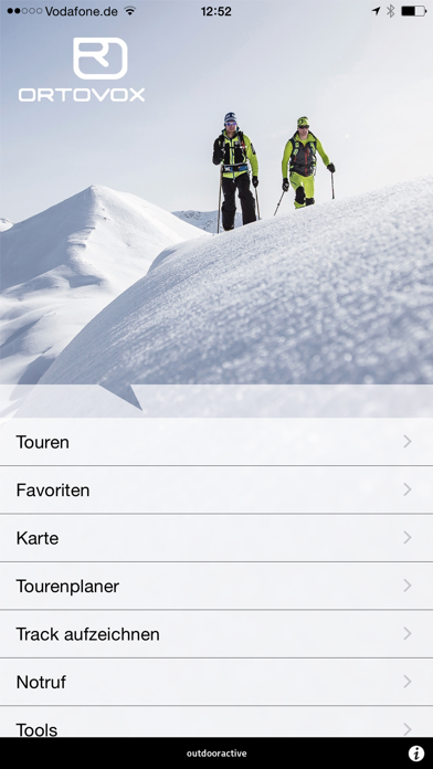
🎌 About ORTOVOX ALPINE TOURING APP
1. As cell coverage in the mountains is not always sufficient, all topographical maps can be saved for offline use and so can be used without relying on cell coverage! The app’s crowning feature is the large and ever-growing database of tours.
2. You can use the tour planner at ortovox.com from the comfort of your own home, to follow the descents along routes with the mouse, set waypoints, add to descriptions and upload images.
3. Once you’ve saved and published the tour it will appear in the ORTOVOX ALPINE TOURING APP (community registration necessary).
4. For the highest possible safety, it is possible to access key data from the avalanche status report, upload it and use it on location to analyze risk.
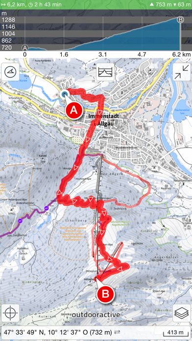
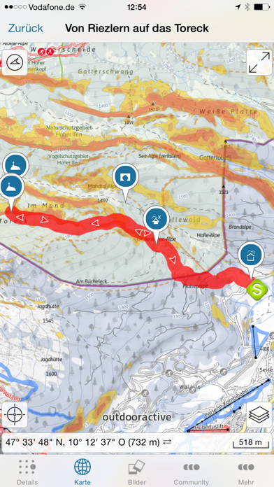
5. In the topographical maps you can set waypoints and view the live height profile for your planned tour.
6. It is even possible to track your tours! The readout gives you information on completed routes, height and duration of an expedition.
7. The maps can be used anywhere in the German, Austrian, and South Tyrolean Alpine regions for determining position and for orientation during tours.
8. By inputting the warning level, slope angle and slope aspect, you can get a safety recommendation based on the data from the DAV Snowcard.
9. The tour descriptions provide you with all kinds of interesting facts, including height profiles.
10. In emergency situations the emergency alarm function can be used to connect to a rescue center, with your current position displayed on-screen.
11. Anyone who wants to improve their knowledge concerning avalanches can do so with the aid of the Safety Academy Lab from ORTOVOX.
12. Also on board: With the summit finder you can access a live image on your iPhone showing all surrounding summits.
13. The map is available both online and offline, and is presented differently for the Alpine region according to the season.
14. ORTOVOX stands for mountain sports – mountains are our passion.