Cancel US Public Lands Subscription
Published by Two Steps Beyond on 2024-07-19Uncover the ways Two Steps Beyond (the company) bills you and cancel your US Public Lands subscription.
🚨 Guide to Canceling US Public Lands 👇
Note before cancelling:
- The developer of US Public Lands is Two Steps Beyond and all inquiries go to them.
- Check the Terms of Services and/or Privacy policy of Two Steps Beyond to know if they support self-serve subscription cancellation:
- Always cancel subscription 24 hours before it ends.
🌐 Cancel directly via US Public Lands
- 🌍 Contact US Public Lands Support
- Mail US Public Lands requesting that they cancel your account:
- E-Mail: apps@twostepsbeyond.com
- Login to your US Public Lands account.
- In the menu section, look for any of these: "Billing", "Subscription", "Payment", "Manage account", "Settings".
- Click the link, then follow the prompts to cancel your subscription.
End US Public Lands subscription on iPhone/iPad:
- Goto Settings » ~Your name~ » "Subscriptions".
- Click US Public Lands (subscription) » Cancel
Cancel subscription on Android:
- Goto Google PlayStore » Menu » "Subscriptions"
- Click on US Public Lands
- Click "Cancel Subscription".
💳 Cancel US Public Lands on Paypal:
- Goto Paypal.com .
- Click "Settings" » "Payments" » "Manage Automatic Payments" (in Automatic Payments dashboard).
- You'll see a list of merchants you've subscribed to.
- Click on "US Public Lands" or "Two Steps Beyond" to cancel.
Have a Problem with US Public Lands? Report Issue
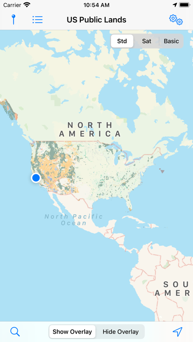
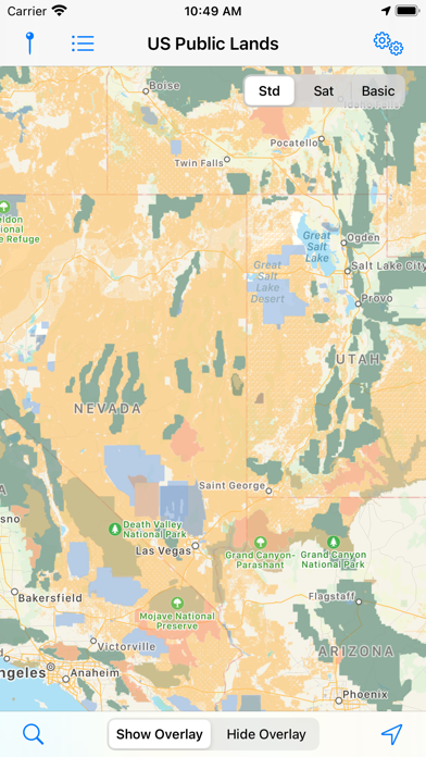
About US Public Lands?
1. - A boondocker's assistant - While US Public Lands is not specifically a camp site locator and does not have a database of specific sites, by turning on the satellite view map, you can better scout out trails, roads and signs of dispersed camping locations within the boundaries of the public land resources.
2. - If you have an internet connection (or have cached them before going out of signal), you can utilize the built in Apple Maps and satellite view maps as the base layer underneath the public land overlays.
3. Thank you to the Protected Area Database (PAD-US) of the U.S. Geological Survey for providing the public domain raw map data that we’ve been able to utilize to create this interactive overlayable mapping & navigation tool.
4. - Links are provided to each agency's website within the app, so that you can further your research as to what land use rules apply for each public land type - such as permits, fees, activities allowed, and limits of stay.
5. US Public Lands allows you to quickly retrieve the boundaries of these properties without carrying physical maps, books, or digging deep online.